My new favorite National Park: Wrangell-St. Elias
Kennecott, within Wrangell-St.Elias National Park may be the most memorable place I visited in 2018. Its ethereal landscapes remain etched in my memory as if I recently dreamt to have been there. This same year I was also so fortunate to have visited Yosemite, the Swiss Alps, and Katmai National Park… places that I knew would be phenomenal— and they fully met— and exceeded my high expectations. What was different about Wrangell-St. Elias, was that I had never heard of it before coming to Alaska, so had no predisposed ideas about what it might be like. Not having seen any photos or read any blogs, I was unaware of the pristine wilderness I was about to discover. My boyfriend Jason and I went there on a tip from our Alaskan friend, Kurt, who said that there’s an old mine town called Kennecott (Kennicott), and that it was well-worth checking out on our last few days in Alaska.


It was mid-September when we arrived at the the Copper Center Visitor Center outside the park. The park ranger informed us that most of the National Park services had just ended for the season. Our visit happened to coincide with Alaska’s very short autumn (I think that tourist services intentionally end before this magical season, so that Alaskans can enjoy it to themselves). It was the most vibrant explosion of yellows and reds my Californian eyes ever did see. I was pulling the truck over every 10 minutes to snap photos of leaves (sorry, Jason!).
So the only issue with arriving after the end of visiting season was: not only would the visitor center at Kennecott be closed, but the park service buses that take visitors into the town of Kennecott had stopped running. This meant that if we wanted to see Kennecott, a 10-mile round trip walk would be necessary just to get there (on top of any walking around the town and hiking). We still had a 3+ hour drive just to where we would start walking, and the ranger tried her best to convince us to go elsewhere. We almost didn’t go. But we said “f**k it, we’ve made it too far to not continue” and got back in the truck…
At sunset we came to the edge of the National Park boundary, where the Chitina and Copper rivers meet. The sky framed by the mountains and rivers looked like a portal into a magical land… and as we soon learned, it was!
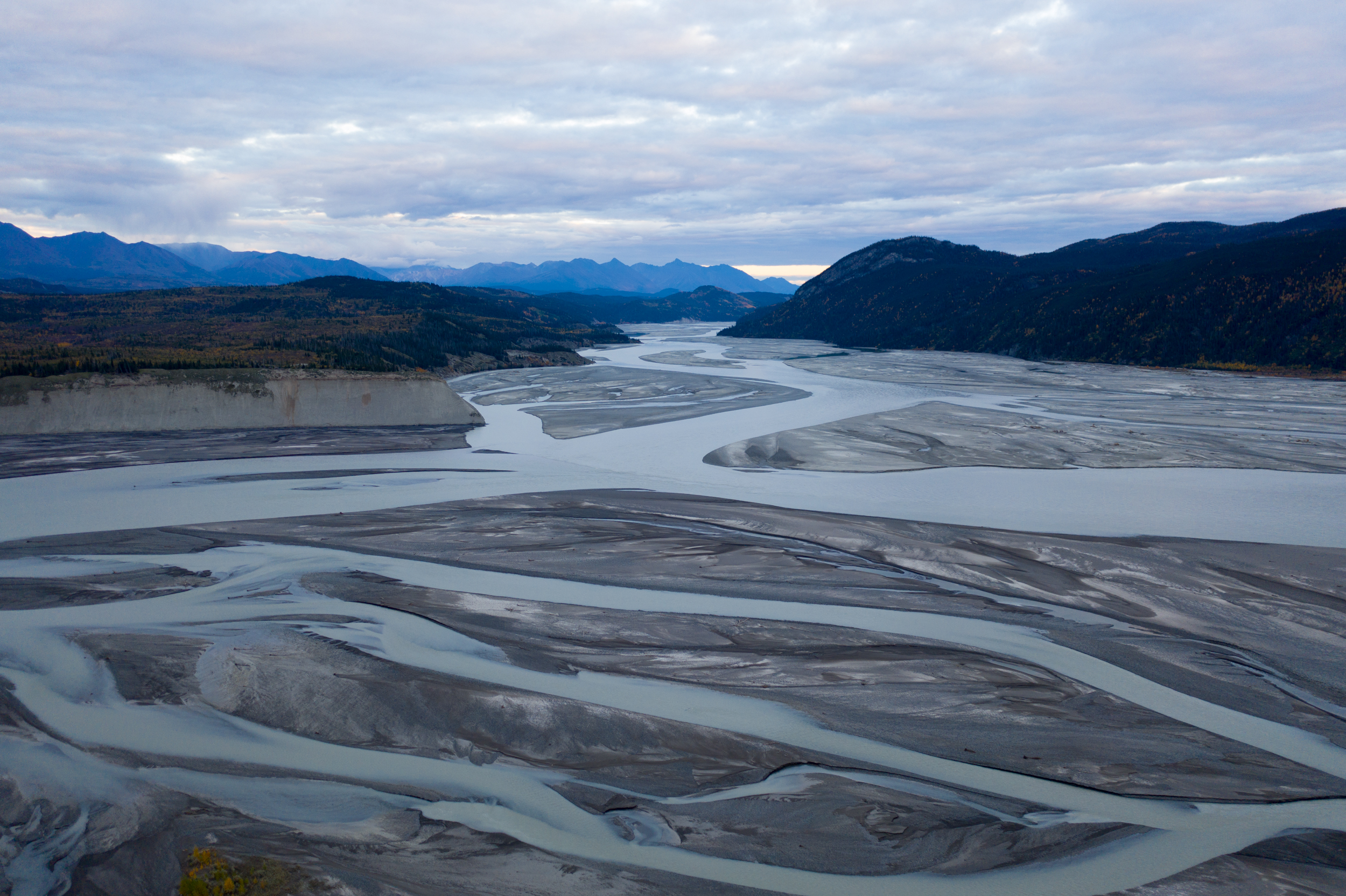
Drone shot looking down the milky glacier-fed Copper River into Wrangell-St. Elias National Park.

We continued driving into the night until our eyelids became heavy, then set up our tent at a pullout on the side of the road for the night. In the morning we finished driving to the small town of McCarthy, where we would start our walk into Kennecott. The town wasn’t much; no grocery stores, no gas stations, no hotels. There was only an occasional person coming or going, and a few seemingly abandoned vehicles and trailers. The road dead-ended at a river, and the only bridge access was blocked to non-residents. We guessed that this was where we were to park and hoof it 5 miles in. We saw a schedule for a private company bus that would run every hour, so we tried our luck waiting to catch that bus. After no bus came, we made the final call to start walking. Don’t get me wrong, I like to walk— but 10 miles of walking on a vehicle road wasn’t how I would ordinarily choose to spend time and energy. I had hopes of trying to do one of a couple of hikes when we got to Kennecott, one of which was a 4000 foot elevation gain over 8 miles up to an abandoned mine (there was no chance we’d make it very far on that one today).
KENNECOTT
We hadn’t even made it one mile down the road when a truck pulled over to pick us up. The cab was completely packed with young travelers, and they cheerfully invited us to hitch a ride in the bed of the truck.
Fast forward 30 minutes and we’ve decided to join the driver of the truck and his friends who were going on a hike to the abandoned mine I had found on my favorite hiking app. Expecting to have to do a 10-mile walk into Kennecott and back, I thought it entirely unfeasible that we would be able to do this hike. But here we were, being chauffeured up the mountain. Our enthusiastic, adventurous driver decided to skip the first half of the hike (in which one has to walk an uphill dirt road), instead 4-wheel-driving his truck up the narrow, bumpy road.
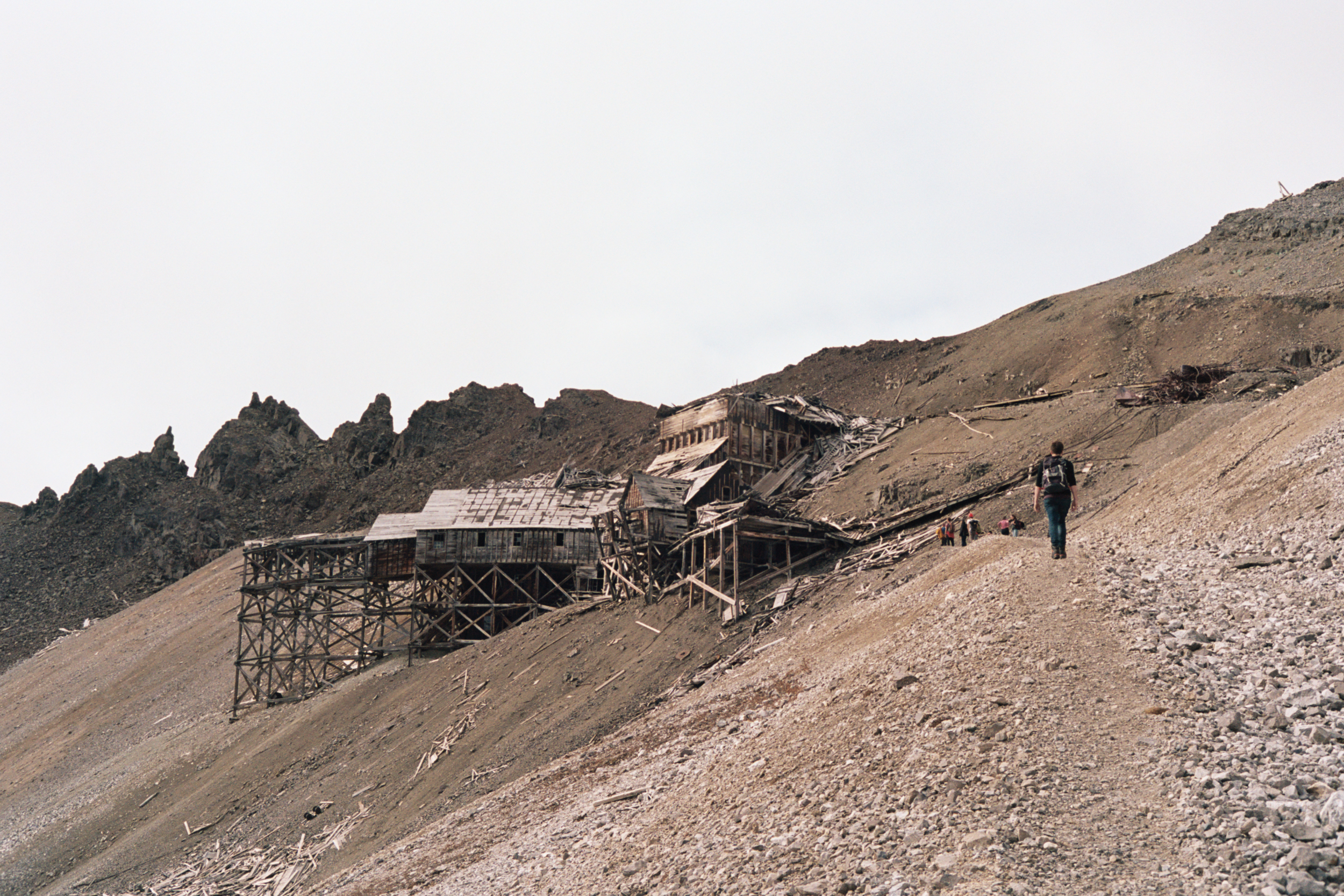

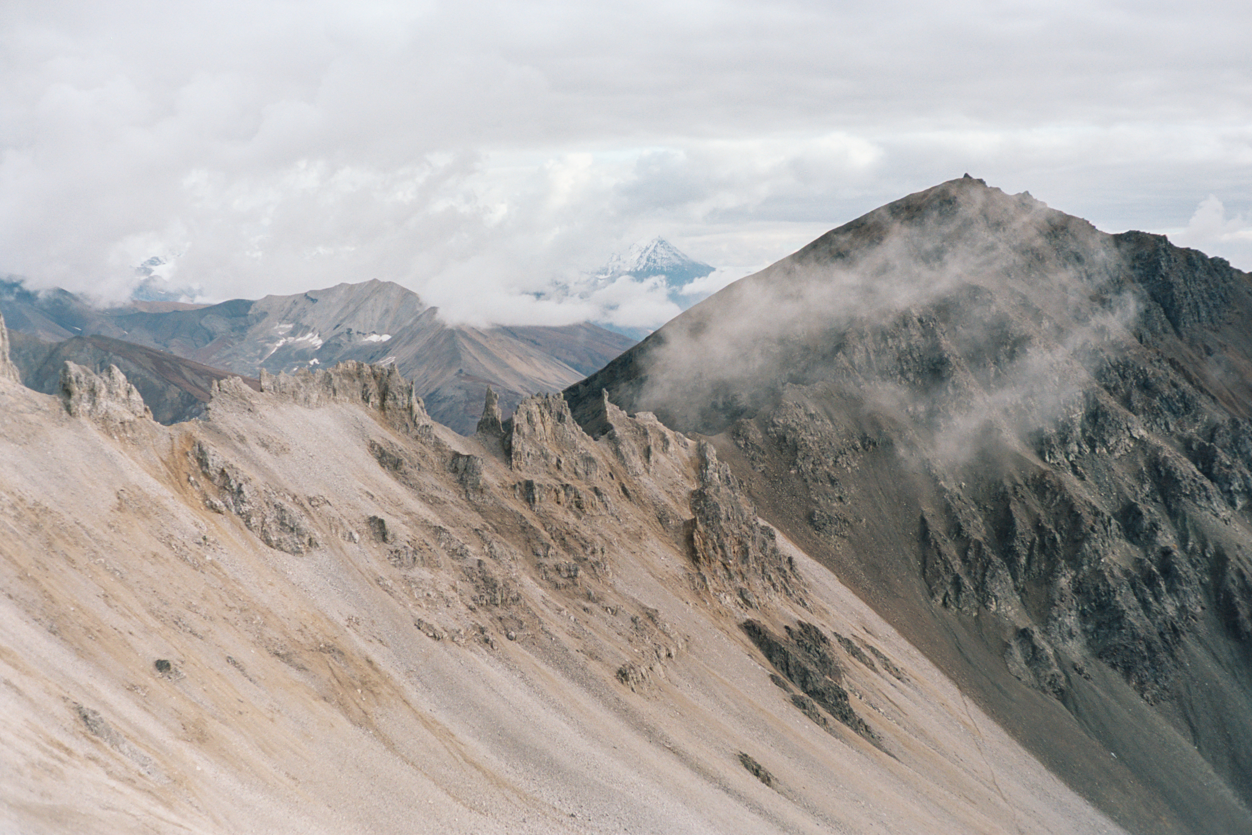
The hike to the top of the mine was a steep incline, and the group of college friends set a blistering pace. As we climbed higher, we ascended above the tree line and into the clouds. Dilapidated wooden structures came into view on the hillsides— old buildings from the tramway that used to carry copper ore down the mountainside for processing in Kennecott.
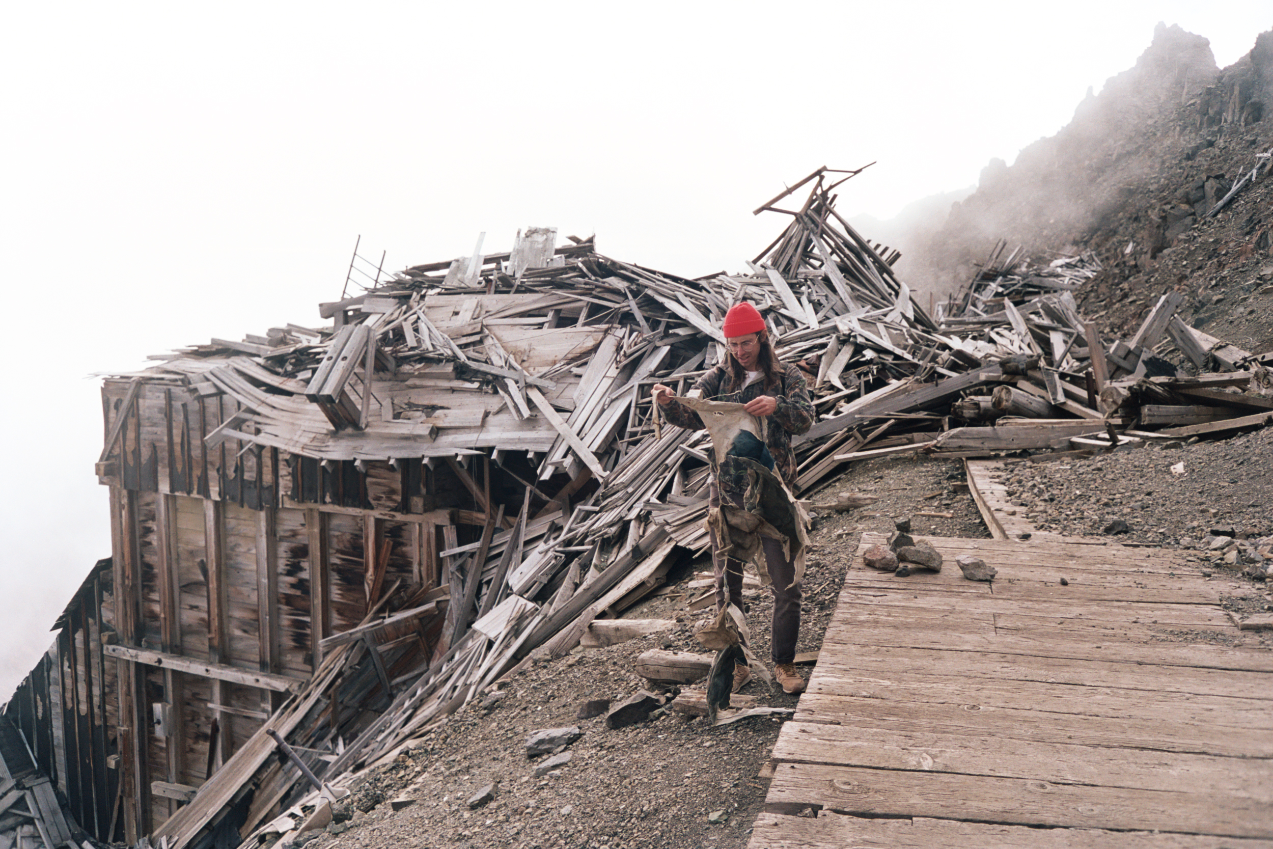
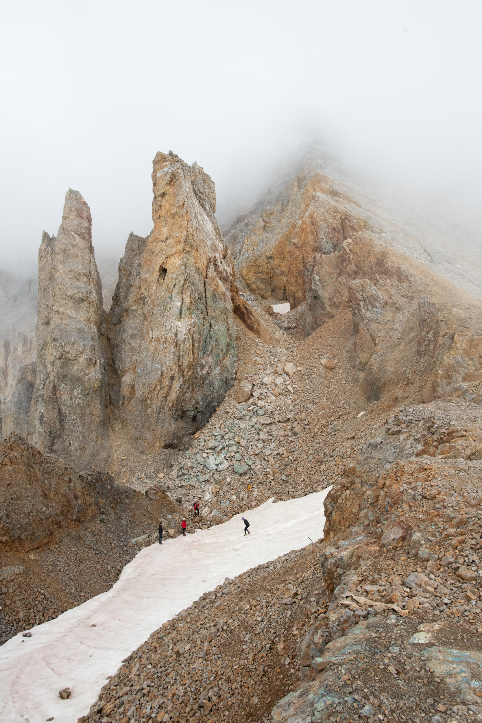
Nearly at the top, we explored the ruins of one of the buildings. In the rubble we came across remnants of old toilets, radiators, denim overalls, a lead block, an intact lightbulb… it was wild! The view of the valley and Kennecott glacier below was mostly obscured by clouds, but an occasional break in the clouds would reveal adjacent peaks of mountains, or the highway of ice down below. We ate lunch with our new friends, explored more of the old mine structures, and climbed up to a patch of snow (probably technically a bit of glacier) between tall rocks where we found a crystal blue pond in a little cave, and then were taught how to “glissade”, basically skiing down the ice in your shoes!
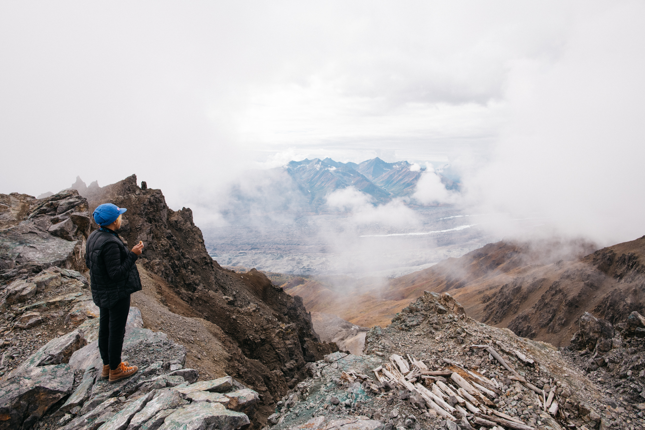

Looking down at Kennecott Glacier in the distance (the glacier is covered with a lot of earth, but you can see lines of clean ice running down it). In a small valley just below us sits a small abandoned mine building.


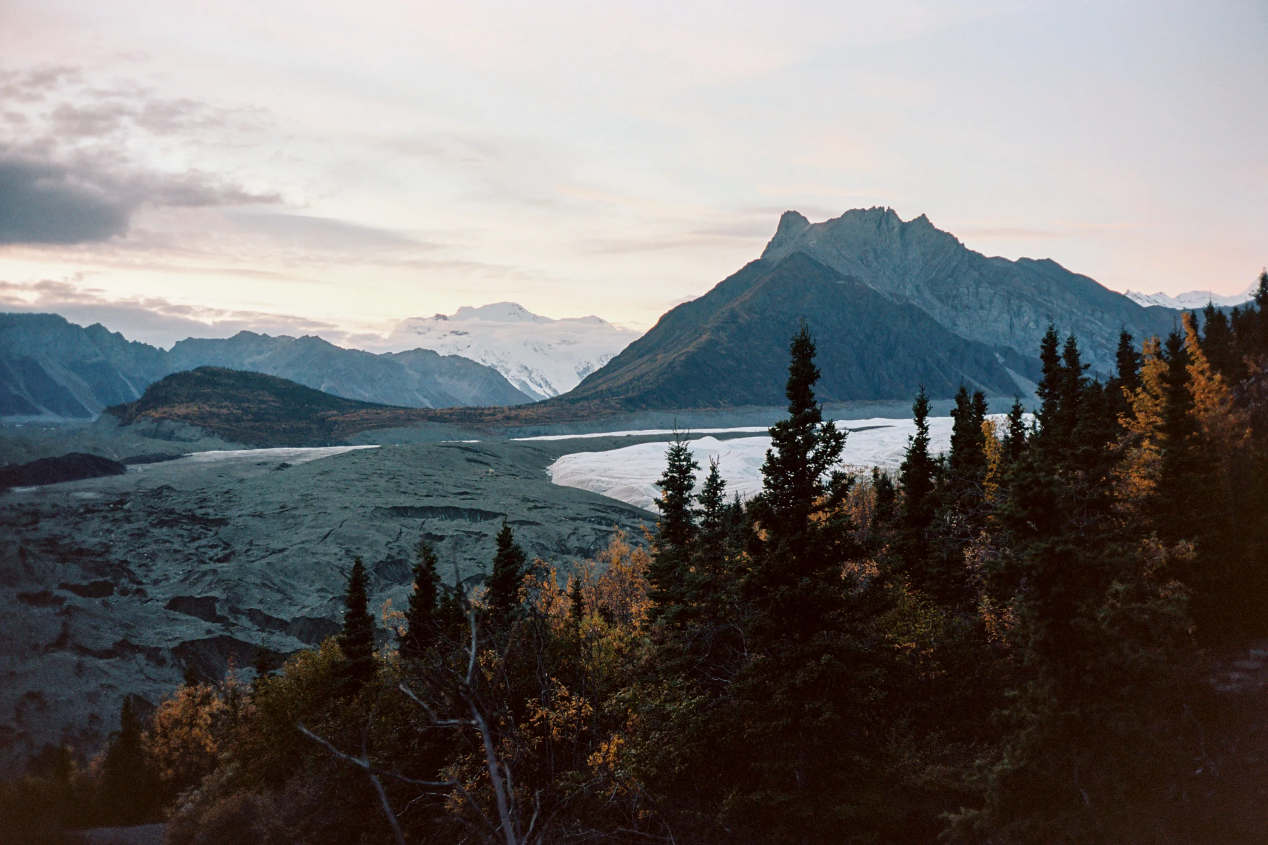
Root Glacier

America’s largest national park also happens to be one of the least visited. Visiting a hardly-visited park after visiting season was over meant empty roads, empty trails, and an empty glacier to ourselves.
After staying the night in McCarthy at one of our new local friends’ cabins, we had a lazy day in before heading out that afternoon on bicycles we had borrowed from the cabin. Rather than relying on another ride that may never come, we pedaled the 5 miles into Kennecott, and packed crampons (also borrowed) to go hiking on Root Glacier. By the time we arrived to the edge of the glacier, the sun was low in the cloudy sky, and the glacier was completely silent. As we strapped on the crampons, the only sound breaking the complete silence was the sound of ice crunching under the spikes on our feet. This place was completely surreal, it felt like walking in a heavenly dream of milky ice and cotton candy skies, with only the fresh, brisk air in our lungs reminding us that this was reality.


We were so busy exploring the mountains and glacier that we only had time to pass through the main stretch of Kennecott on the way in and out.